Report
Shoshone on Memorial Day
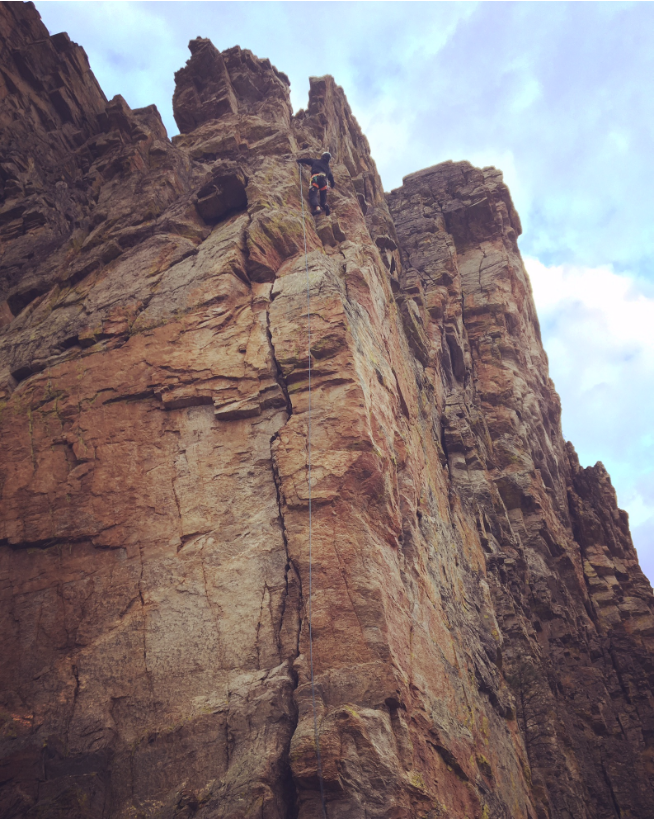
After yesterday’s failure on No Sweat Arete, we went for Shoshone on Sunday, with perfect weather… sunny skies, warmer temperatures, no wind. We hiked in and easily found the correct spire and found the traditional stream crossing. However, it was still early season, so the stream was roaring, and no easy crossing was to be…
No Sweat Arete 5/23/2020
Goodness was this a rough day! Location of climb on Mountain Project is totally wrong Cold, cloudy, windy, and a potential storm rolling in Ticks, ticks, and more ticks The first thing that went wrong was the approach. On Mountain Project, the crag’s location is set to be around the main crag wall. That also…
Weather
Weather at crag/No Sweat Arete (updated 5/21/2020)
- Sat: 37/56, mostly cloudy, 30% chance of rain
- Sun: 39/64, mostly sunny
- Mon: 42/71, partly sunny
- Tue: 50/74, mostly sunny, a chance of rain
Weather at Shoshone (updated 5/21)
- Sat: 33/49, mostly cloudy, 40% chance of rain, 8-10 mph winds with gusts to 18 mph
- Sun: 34/58, mostly sunny
- Mon: 39/64, mostly sunny, slight chance of rain after noon
- Tue: 45/67, mostly sunny, slight chance of rain
If you are quarantining (e.g. have come from or traveled out-of-state) you cannot leave for groceries, public outdoor recreation (including hunting/fishing), to go to work or any other activity. You must remain at your place of quarantine for the duration of the quarantine period (14 days). Exceptions will only be made in the event of a medical emergency or natural disaster.
Quarantine expires June 1st: https://www.visitmt.com/travel-alerts.html
National Guard might even be screening temperatures at borders and informing of quarantine
Map: https://caltopo.com/m/VP5T
Google My Map: https://www.google.com/maps/d/edit?mid=1-Eyt0JcmVjlRSCK3fd7MQYQs8a6rcQa5&ll=46.5398571028817%2C-114.17779025054557&z=14
Friday – Drive to Hamilton
8:30 hr drive
- 12:00 PM – Depart
- 10:00 PM – Arrive, check in with self entry key box (Montana’s 1 hour ahead of us, so we lose time)
Saturday – No Sweat and cragging?
- 6:30 AM – Leave house (23 min drive to Mill Creek Trailhead)
- 7:00 AM – Start hiking
- 8:00 AM – At base of No Sweat Arete
- 8:15 AM – Start climbing
- 12:00 PM – At summit
- 12:15 PM – Walk off back around to the Tick Farm Crag
- 12:45 PM – Do some more cragging at Tick Farm, 5.8-5.10 sport
- 4:00 PM – Walk back to car
- 4:45 PM – At car
Sunday – Shoshone
- 6:00 AM – Start hiking
- 8:00 AM – At base
- 8:15 AM – Start climbing
- 1:30 PM – At summit
- 1:45 PM – Descend
- 2:45 PM – At base, hike out
- 4:00 PM – Back at car
Monday – Arch
- 6:00 AM – Start hiking
- 9:00 AM – At base
- 9:30 AM – Start climbing
- 11:45 AM – At summit
- 12:30 PM – Back at base
- 12:45 PM – Hike back
- 3:00 PM – Back at car
Tuesday – Crags on way out?
Have to see what’s open
- 10:00 AM – Drive home
- 6:00 PM – Home (we gain time driving back)
No Sweat Arete – 5.7, 4 pitches
Protection: Double rack, alpine draws very useful. 60m rope.
Approach: 45 minutes, involves 4th class scramble, can be a bit tough to find (read comments)
Descent: Follow the trail to the east off of the ledge to gain a saddle, and descend this eastward on the trail. Walk off does NOT return to base, so bring gear up.
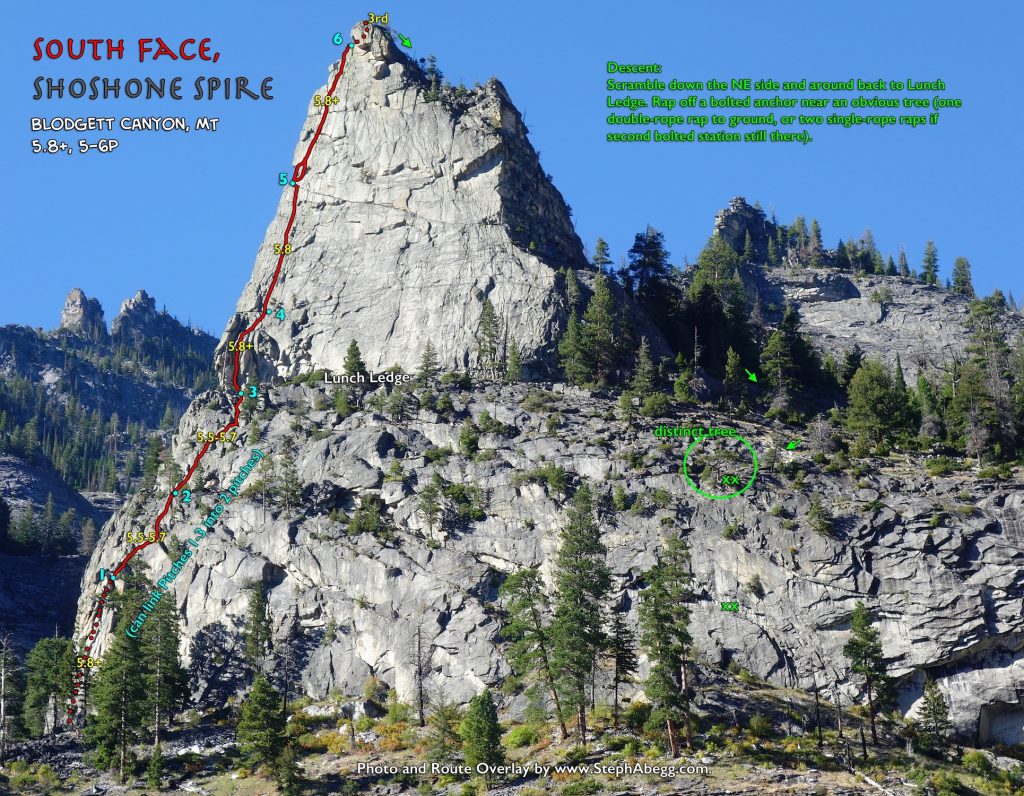
Shoshone South Face – 5.8+, 5 pitches
Consistently 5.8 (only one 5.7 pitch). Finding the start can be a bit tricky, there’s a comment that explains the offwidth options.
Steph’s info: http://www.stephabegg.com/home/tripreports/montana/blodgett2018#shoshone
Protection: Double rack to 3″, nuts, one sling for a tree rappel. 60m rope.
Approach: 2.5 miles, 1,800 ft gain, about 1.5 hours? Road looks fine for sedan.
Descent: Walk off east side down some slabs, follow gully down until cliff band, then do two rappels using 60m rope on two bolted chain anchors.
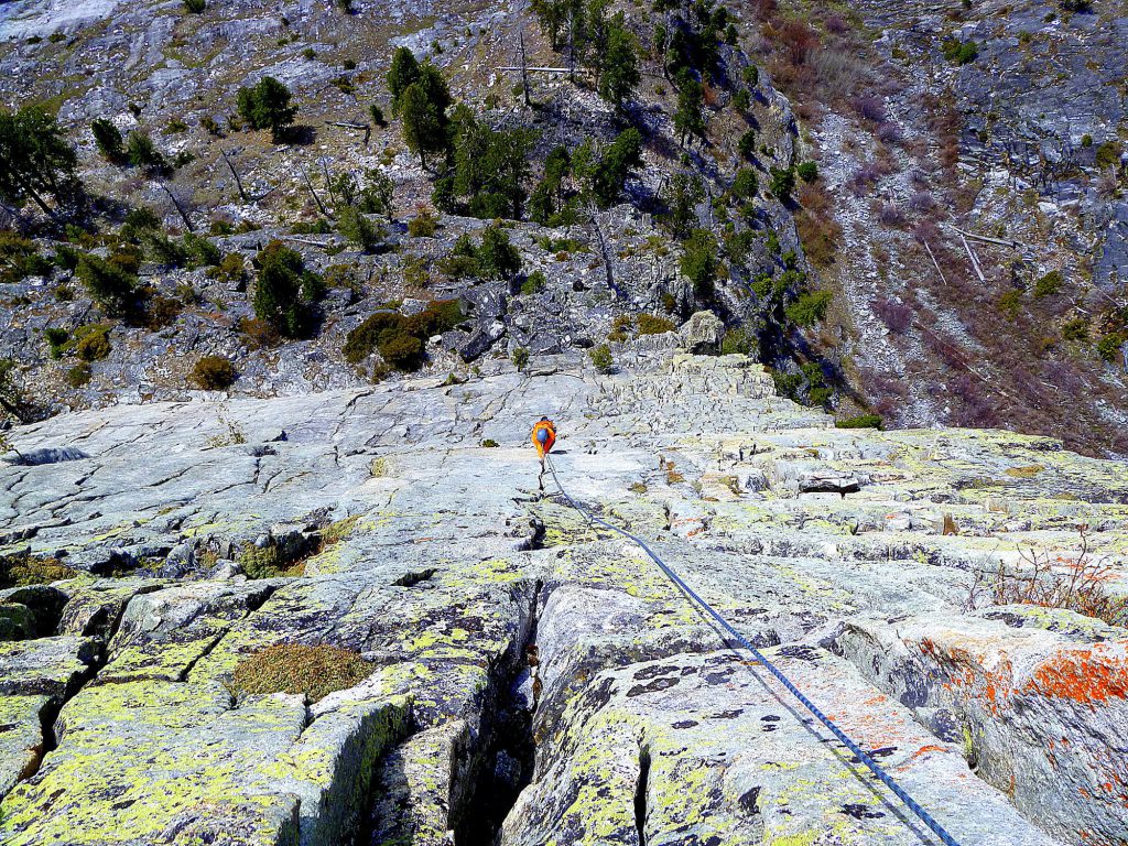
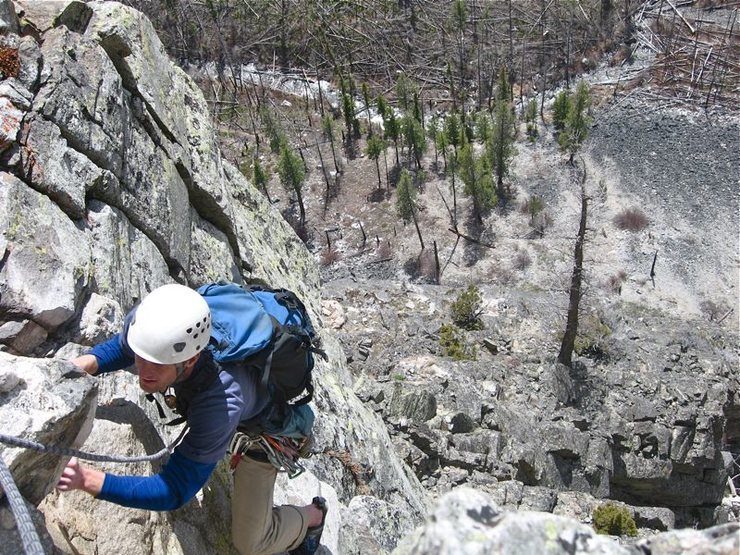
Shoshone Spire 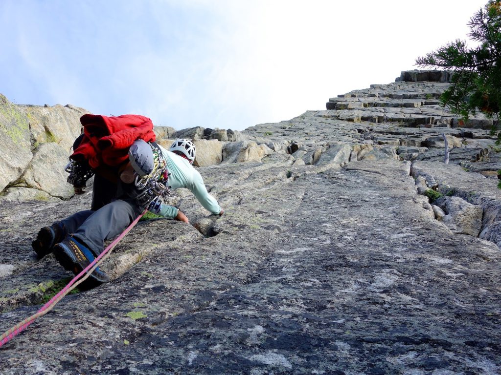
Pitch 5 of South Face of Shoshone Spire.
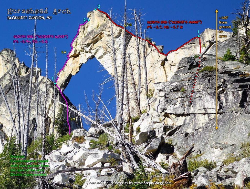
Horsehead Arch – 5.9+, 2 pitches
Steph’s info: http://www.stephabegg.com/home/tripreports/montana/blodgett2018#horsehead
Double ropes needed to rappel. One pitch of 5.9+, then 5.6. Looks well protected.
Protection: Singles to #3, doubles of #1 and #2. Nuts. At least one long sling for slinging horn below summit.
Approach: 3.5 miles, 2,400 ft gain, about 3 hours
Descent: Double rope rappel by counter balancing on opposite sides of the arch (simul rappelling). About 160 ft to the top… so if we brought a 40m rope, that’s 130 feet… worst case could lower the remaining distance?
Horsehead Arch. 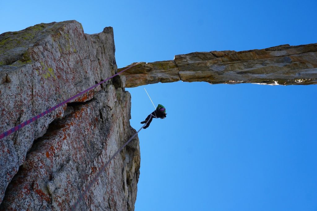
We descended by doing a counterbalance rappel from the apex of the arch. 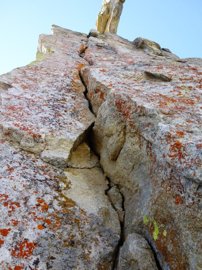
Pitch 1 on south side of Horsehead Arch. Felt about 5.9.
Tick crag
http://millcreekreport.blogspot.com/
Big Creek Crag
A few 5.9 and 10 sports
https://www.mountainproject.com/area/113093231/big-creekmccalla-ridge
Kootenai Canyon Crag
A few 5.8 and 5.9 routes, a couple that are 2 pitch
https://www.mountainproject.com/area/106546694/kootenai-canyon