In the middle of nowhere!
Apparently Middle Fork had a landslide on Dec 31, 2019, and is still probably closed because of that. Mid-summer is earliest estimated reopoening.
Big thanks to
- https://cascadeclimbers.com/forum/topic/102286-little-big-chief/?tab=comments#comment-1154989
- https://cascadeclimbers.com/forum/topic/866-first-ascent-on-little-big-chief-mountain/
- https://www.summitpost.org/little-big-chief-mountain/421526
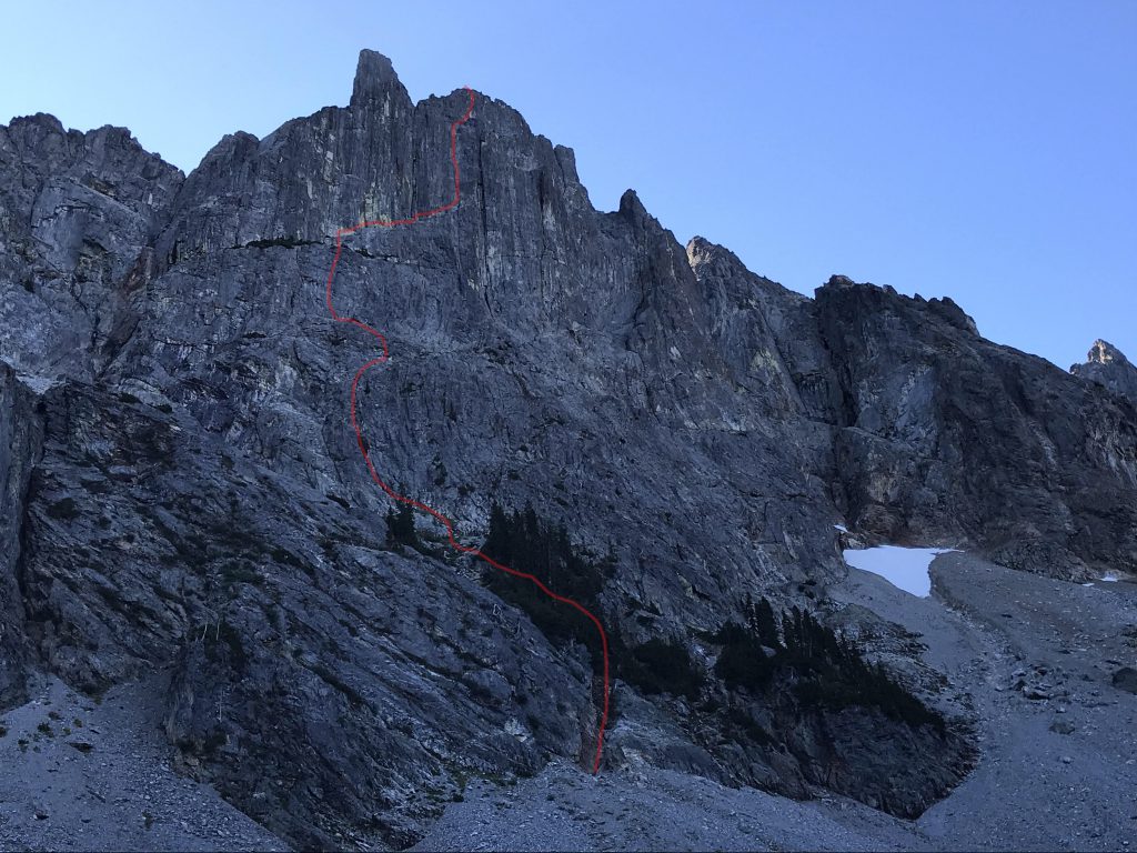
Little Big Chief Mountain, Falcon Route. Jeff Hansell and I made this new route (IV 5.9) on September 10,2001. Little Big Chief Mountain is located in the seldom-visited Summit Chief Valley in the North Central Cascades. The Summit Chief Valley is a tributary of the Middle Fork of the Snoqualmie River Valley. The route is never really hard, but is remote and demands a variety of alpine skills. From the end of the Middle Fork Valley Road, hike up the valley for about three hours. At a small steel bridge, leave the trail and hike cross-country in a southerly direction to the entrance of the Summit Chief Valley. The objective should be visible on the east side of the valley. Hike up into the Summit Chief Valley until you reach the flat gravel wash at about 4,650′. There are great low-impact camp spots.
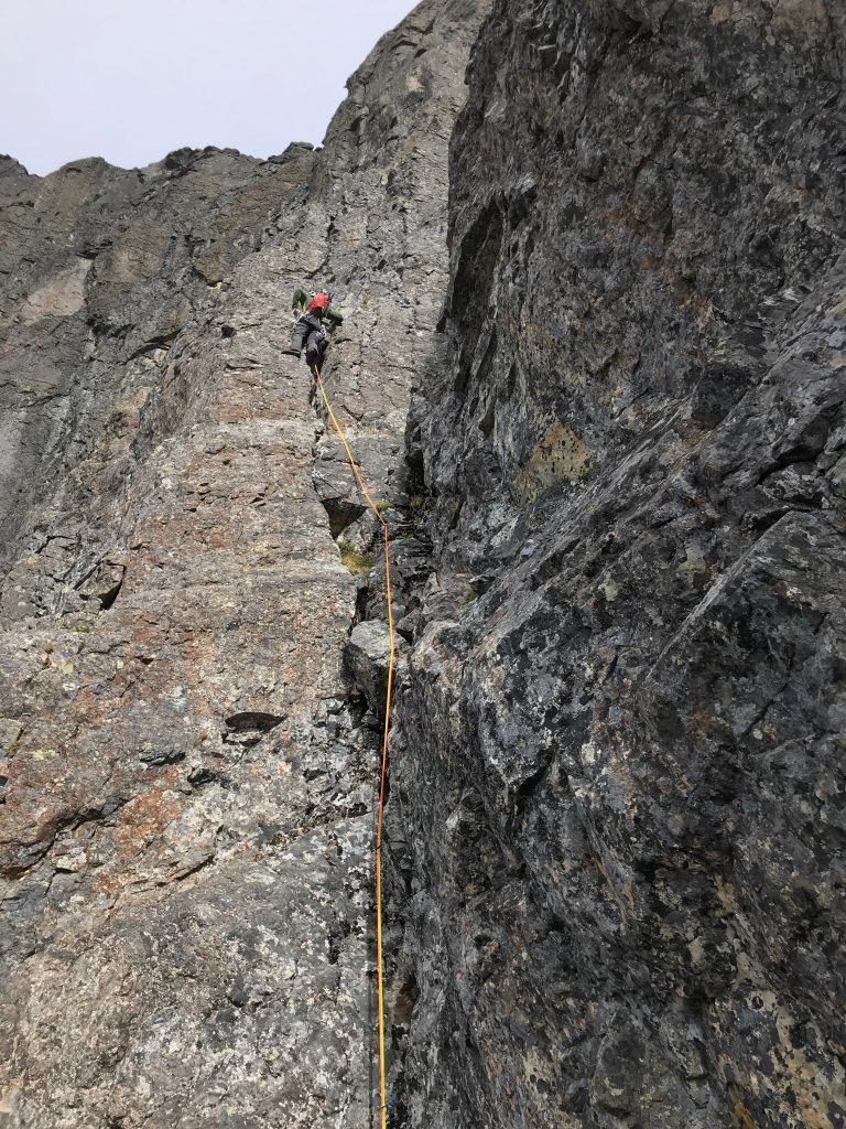
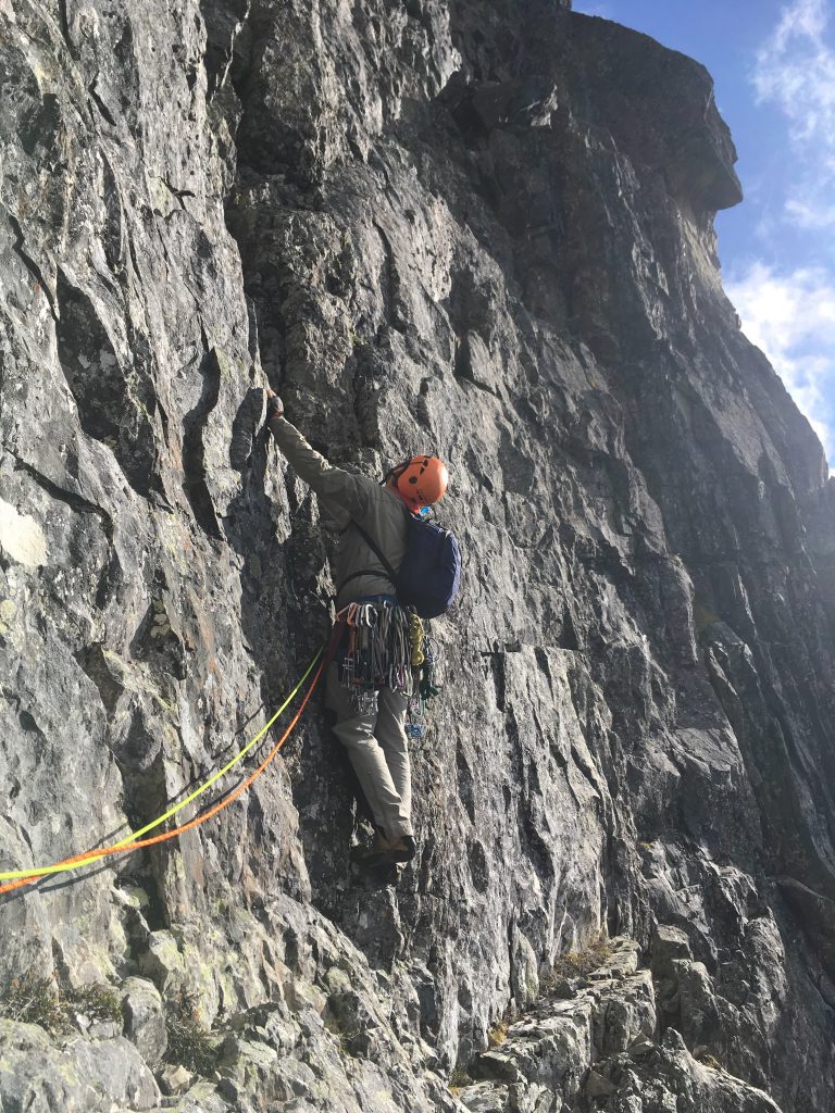
From camp ascend a talus field for 900 feet to the base of the route at a prominent left- trending gully. Follow this for 50 feet; move right to a dead tree. Go up and right to another dead tree and continue to easier terrain. Ascend sloping heather benches to the prominent right-trending ramp and follow it to the beginning of difficulties, just left of the prominent chimney. The First pitch features an undercling to the right (5.8). On the second pitch, climb a groove for 60 feet, then move left onto a rib and into another groove. On pitch four climb a steep headwall (5.9) to yet another groove. Follow this groove on pitches five and six (5.7/5.8) to easy terrain and a big ledge, which is at the elevation of the top of the prow to your left. Pitch seven trends slightly right to a ridge near the summit crest. On pitch eight keep traversing right on exposed rock to the crest (5.7). Class 4 climbing on the narrow ridge leads to the 7,225′ summit.
Descend the ridge to the south for several hundred feet, then turn left and gain a pocket glacier. Go down the pocket glacier and trend left over glacier-polished slabs. Keep trending left and reach the ridge crest at 5,400′. One to two rappels then take you back into the Summit Chief Valley. Continue trending left, follow goat ledges, then descend through steep forest to camp.
On 8/28 UIAGM guide Martin Volken (Pro Guiding Service) and Jeff Hansell completed a first ascent in a very lonely part of the Alpine Lakes Wilderness The route goes up the 1800 foot North West Face of Little Summit Chief Mountain (7225 feet).
https://cascadeclimbers.com/forum/topic/866-first-ascent-on-little-big-chief-mountain/
You start climbing at 5400 feet. Up to 6100 feet you will encounter the classic “easy – dangerous” terrain of 4th and low fifth class. There are a few steps of 5.6 to 5.8 in there. At 6100 feet the wall steepens substantially and the next 8 to 9 pitches follow a very classic line up the middle of the face.
pitch 1: 5.8 plus; Pitch 2: 5.7; pitch 3: 5.6; pitch 4: 5.9; pitch 5: 5.7; pitch 6: 5.8; pitch 7: 5.6; pitch 8: 5.7
Now you gain the summit ridge a short distance from the summit. One can folow under the ridge on easy terrain and then climb the last 50 feet to the summit or enjoy awesome exposure right on the crest and follow this to the summit.
Rock quality is good to very good (vertically striated gneiss), protection is very good (cracks), ambience is excellent, and general commitmentlevel can be compared to the Back Bone Ridge on Dragontail. The descent is harder than on Dragontail some rapelling, not as obvious routefinding.
Route rating: Grade 3 plus to 4; 5.8 plus to 5.9 .
Route time from camp in the Summit Chief valley. 6 to 10 hours to the summit and 3 to 5 back to camp.
The overall experience of climbing in the area is outstanding and the thought of having the Middle Fork Road closed is very sadening. If you are opposed to the proposed closure of the road please contact the North Bend Ranger district and let them know. They are preparing an EI study and they need to hear from people who want to keep access to beautiful places open.


