The standard route up Index. In winter, it’s only class 4.
A slightly technical winter summit
Mount Index is mostly just a steep snow climb in the winter, with one steep snowfield that some choose to rappel back down.
Approach
Hike to Lake Serene on the normal trail.
Gear
- Microspikes (trail is often icy)
Lake to Saddle
From the end of the trail, follow along the right (West) side of the lake to the 3,080 ft saddle. The left (East) side of the lake might seem shorter, but apparently it’s more cliffy and tougher to walk along.
Gear
- Snowshoes?
Camp at Saddle
The saddle is the required 1/4 mile from the lake, so you’re allowed to camp there.
Saddle to Headwall/Hourglass Gully
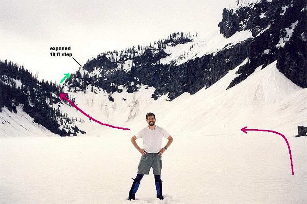
From the saddle, continue up the ridge heading south, southwest. In the summer, this is an awful bushwack. But in the winter, it’s just a snow field! There might be a 10 ft exposed rock step that involves grabbing lots of roots to get up. Many rappel back down this. When the ridge opens up at 3,800 feet, head further south, southwest towards a large headwall in that direction. Round the corner from the headwall and you’ll see the start of the gully.
Gear
- Snowshoes?
- Rope
- Belay device
- Slings to build anchor
Hourglass Gully
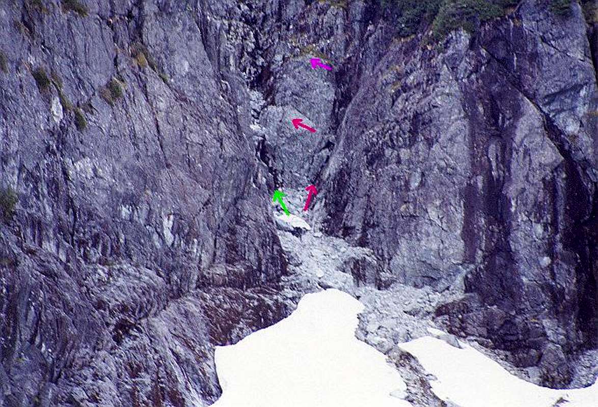
The gully is the steepest part. Around 4,800 feet, where the gully constricts, there’s normally a waterfall in the summer, but it’ll be covered with snow in the winter. It’s still apparently 30 to 40 degrees steep though. Some people choose to rappel back down this due to its steepness.
Hourglass Gully in summer from the bottom
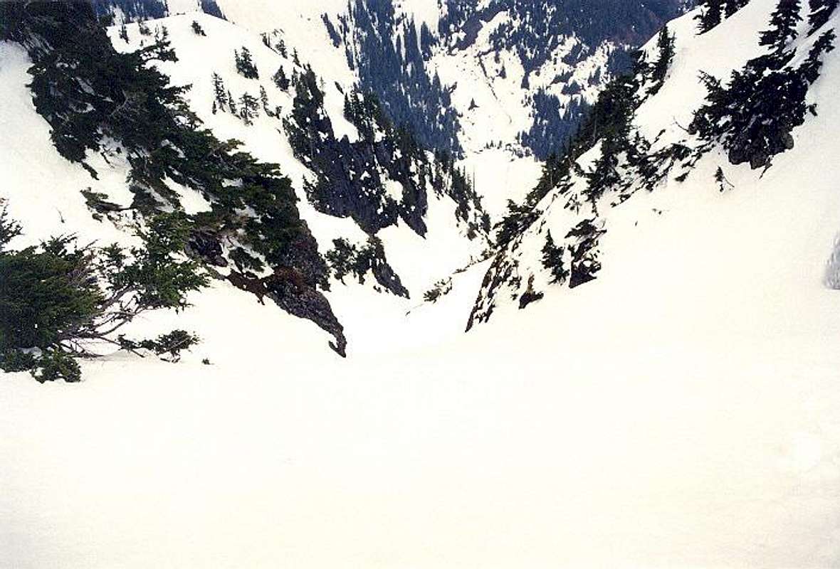
Hourglass looking down from the top in winter
After the steepest part, head to the couloir straight ahead of you, the widest couloir. It’s due West.
Gear
- Crampons and boots
- Ice axe
- Picket (in case decide to rappel)
- Rope (in case decide to rappel)
- Belay device
- Snowshoes?
Couloir to Summit
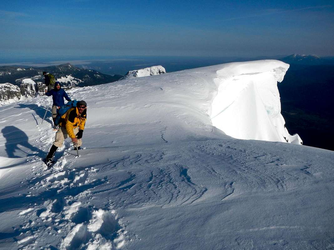
From the couloir, head straight north up the hump and continue towards the summit. To avoid any impassable cornices, stay to the left (West) side of the summit. This part is pretty easy! You’re only about 0.7 miles from the summit with just 400 ft of gain left!
Large cornices at top
Summit!

Reports
Frogland May 2022
Overall If it weren’t for the runout, this would be a 4-star route. The approach is super easy, the climbing is overall fun, the belay ledges are nice, the descent (walk off) is super nice, it ends on a summit, etc. But the freaking runout… it was barely within my comfort level (and I consistently…