The Beacon Guidebooks backcountry ski book mentions nothing about cliffs on this route or the key direction to exit right after Martini Bowl, and lists the max slope angle as 35 degrees. Yet we ended up cliffed out above a cliff that was probably about 80 feet of 50-60 degree ice and rock. Here’s the story (and why to NOT trust anything in Beacon Guidebooks).
Ascent
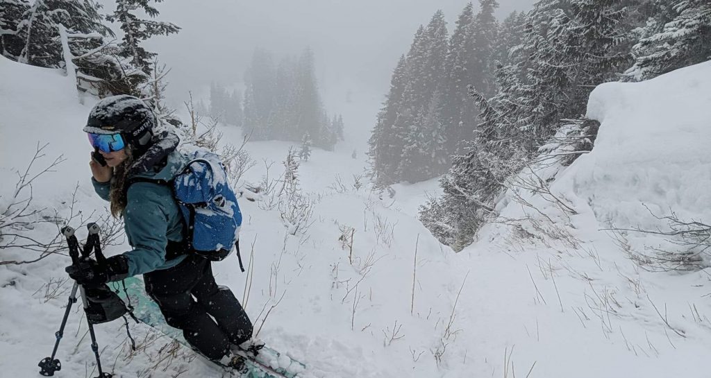
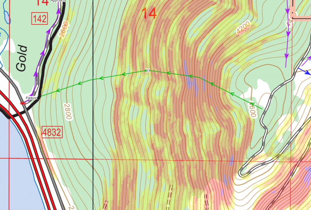
The ascent was pretty straightforward, an old road switchbacks up the hill, and then we finally traversed up the ridge till it seemed to cliff out (we had no interest in going to the very top which would likely require a rappel to start the route and opted for the early side approach that doesn’t require a rappel).
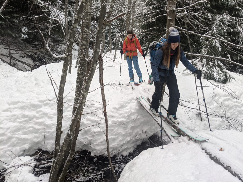
Occasional crossings 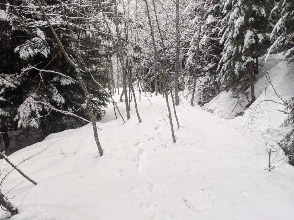
Occasional trees, usually a good road 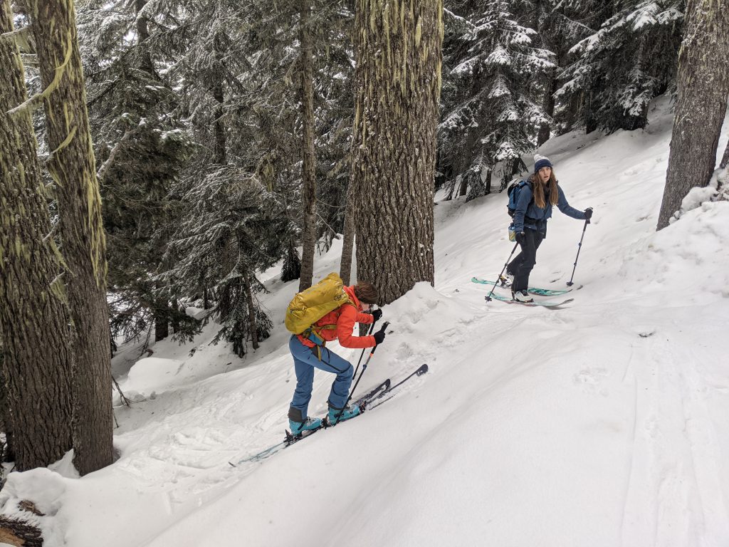
Steep and hard packed snow while going up final ridge
Descent
To start our descent, we started cutting across the steep forest towards the gully, as the book describes, which worked pretty well. We were able to enter the gully reasonably, and once in the gully, it was pretty good, blue to black steepness. At the bottom of Martini Bowl, there was one icy constriction about 15 feet wide with a bulge in the middle and then 5-10 feet of 45 degree ice which we all slid and crashed down, but aside from that it was pretty sweet. We continued down the gully.
Traversing to the gully 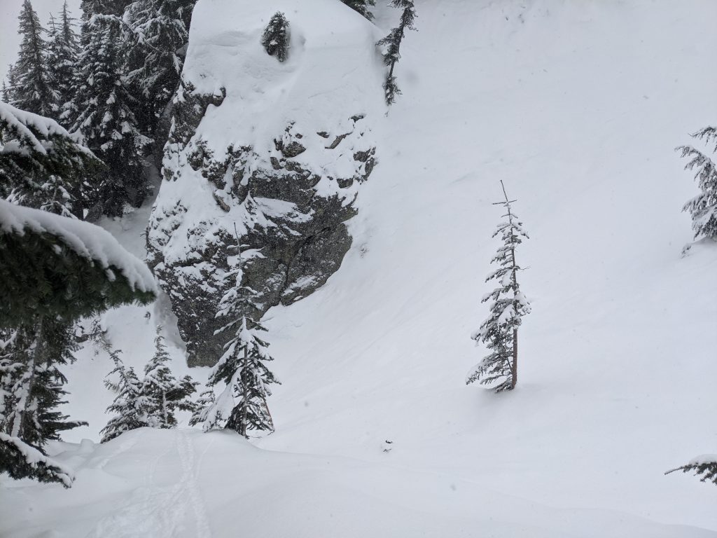
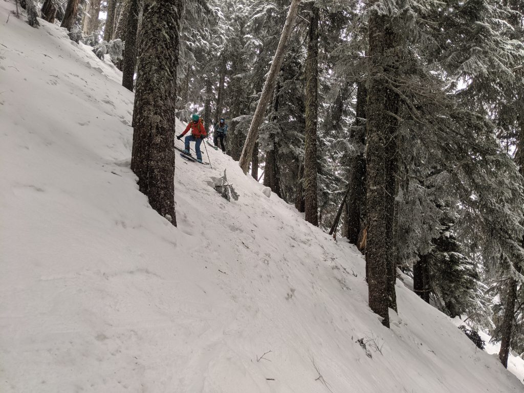
Our entrance to the gully 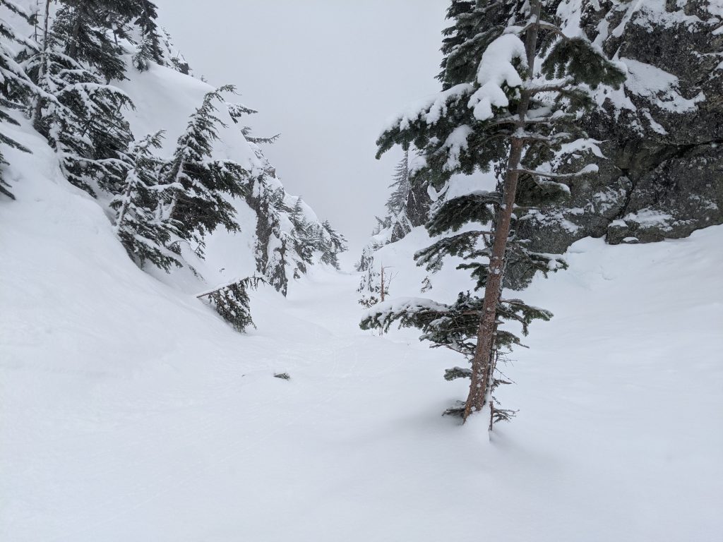
The start of the gully! 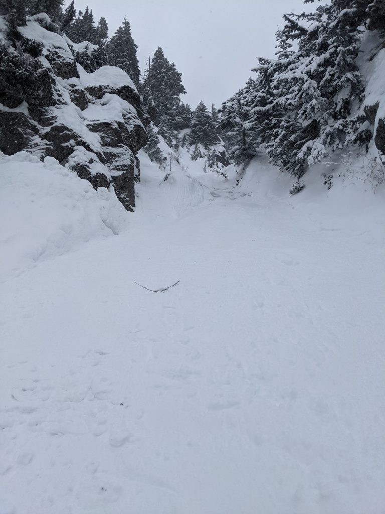
Looking back up at the icy constriction, doesn’t look steep, but photos looking up never look steep 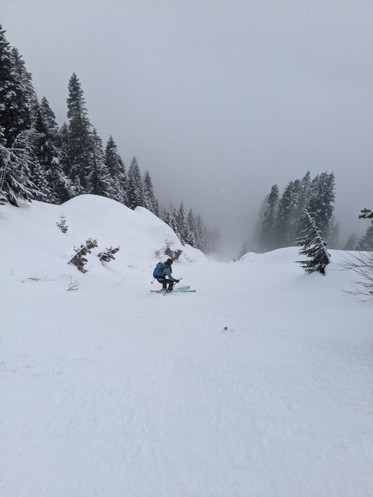
More excellent gully after the constriction!
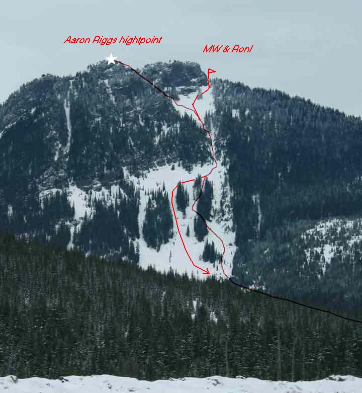
Cliffed out
But then we came to another constriction that looked much worse than the last. Liv was skiing first and stopped about 10 feet from the edge. I came up behind her to inspect it together. We both determined it seemed like it’s probably insanely steep for way too long of a distance. Alexis was coming up behind, so we told her to stop a bit higher up rather than getting back down to where we were, since we weren’t sure there was a way out where we were.

Indeed, it was probably about an 80 foot cliff of 50-60 degree ice and rock (we confirmed, there were rocks sticking out on the cliff as we were rappelling down). And the angle didn’t mellow out for about 200 or more feet. Skiing that would be a triple black, or maybe not even possible! Definitely not “35 degrees”, that’s for sure.
Missed turn
The guidebook does nothing to tell you the key information to exit right after Martini Bowl rather than continuing down the main gully. The guidebook simply says…
Earned the name from the shape of the run and watching avalanches flush through the mid run chute, emptying debris at the bottom. The top can be very difficult to access from the ridgetop, except for the climbers left above the bowl there is a steep chute that may require a rappel, otherwise enter from the skiers left/south side of the bowl just below the ridgeline.
Beacon Guidebooks
And no, the rappel mentioned is not on our route, we chose the “otherwise enter from the skiers left” option which successfully avoided the mentioned rappel.
After hours of additional research and finally realizing that people call this route Toilet Bowl, I finally found a trip report with a photo that has the key info… we were supposed to exit right in that open area after the Martini Bowl constriction.


Messed up guide book
So, what gives, guide book? How do you not decide to mention something like this? Our descent identically matched what the description in the book said: “Named from the shape of the run and watching avalanches flush through the mid run chute, emptying debris at the bottom. Enter from the skiiers left/south side of the bowl just below the ridgeline.” It says this route has a max slope angle of 35 degrees.
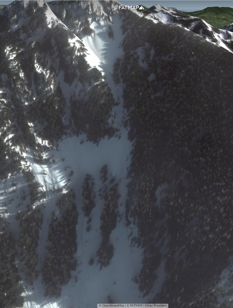
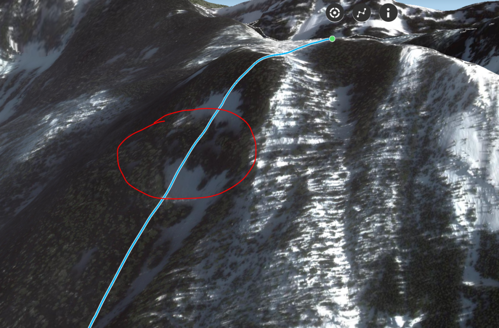
Their line on their map seems to do something slightly different though and go up over an additional ridge, and then straight down a lengthy section of 50-60 degree slopes, which look like even worse cliffs (We carefully traced the exact line they drew on their guide book map and then plotted that onto Fatmap as seen below). So their map seems even more ludicrously wrong and it’s as if they blindly drew it without even checking slope angles or checking a satellite map to even make sure it’s going down Martini Bowl.

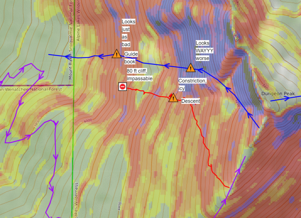
It seems that the guide book is complete bullshit. It also includes a route nearby on this ridge, but the route it has drawn on the map explicitly goes through a 50 degree cliff band, when that could be easily avoided.
Moral of the story – Don’t trust Beacon Guidebooks
Unless you enjoy being cliffed out and stuck, don’t buy this guidebook and don’t trust it. We had to get rescued and rappel about 220 feet through these cliff bands, as we were essentially stuck in a tight narrow gully on the edge of a cliff (and the snow was too icy and steep for one of us to feel safe sidestepping or booting back uphill). Aside from having a harness and a rope to rig that person to feel safe, nothing else would have helped self extract in that scenario.